Property Record
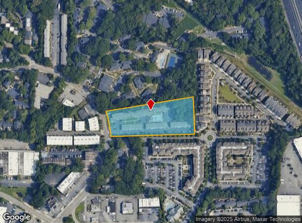
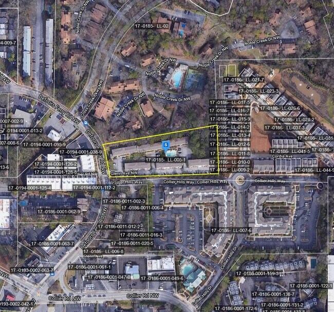
2113 Defoors Ferry Rd Nw, Atlanta, GA 30318
NEARBY LISTINGS FOR SALE OR LEASE
Property Detail
2113 Defoors Ferry Rd Nw
Atlanta-Sandy Springs-Roswell, GA
Westside
17-0185-LL-005-1
KA WESTSIDE COURT APTS 48 UNTS- MGT. ADRIENNE HOWARD FLD CK 9/7/23; PARCEL REVIEW CB25 COBALT MGMT NO ONSITE RENTAL OFFICE
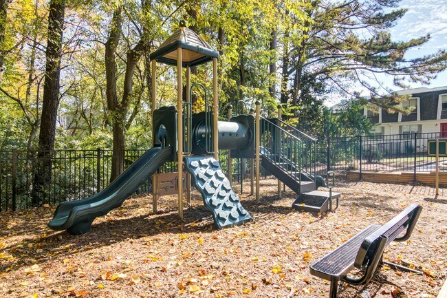
Apartment
Fulton
X
Georgia
13121C0233F
185
2024
2.65 AC
2025
Cross Creek
008907
Atlanta
155,961 SF
DEMOGRAPHICS near 2113 Defoors Ferry Rd Nw
1 Mile
3 Mile
5 Mile
2024 Total Population
12,272
100,485
340,058
2029 Population
12,490
104,160
353,162
Pop Growth 2024-2029
+ 1.78%
+ 3.66%
+ 3.85%
Average Age
34
36
37
2024 Total Households
5,998
48,892
166,054
HH Growth 2024-2029
+ 1.80%
+ 3.95%
+ 4.12%
Median Household Inc
$111,116
$94,522
$89,716
Avg Household Size
2.00
1.90
1.80
2024 Avg HH Vehicles
2.00
1.00
1.00
Median Home Value
$494,709
$615,274
$514,320
Median Year Built
1980
1996
1996
Nearby Places
Map Layers
Map Styles
 Street
 Aerial
- Restaurants
- Banks
- Shops
- Fitness
- Groceries
PUBLIC TRANSPORTATION
COMMUTER RAIL
Atlanta (Crescent - Amtrak)
DRIVE
WALK
Distance
Atlanta (Crescent - Amtrak)
6 min
2.8 mi
AIRPORT
Hartsfield - Jackson Atlanta International
DRIVE
WALK
Distance
Hartsfield - Jackson Atlanta International
25 min
15.4 mi
Freight Ports
Georgia Ports - Savannah
DRIVE
WALK
Distance
Georgia Ports - Savannah
288 min
254.8 mi
SALE & LEASE HISTORY
LISTING DATE
SALE/LEASE

Nov 22, 2020
For Sale
Nearby Properties
Address
Land Use
TOTAL SIZE
Lot Size
Zoning
Address
Land Use
TOTAL SIZE
Lot Size
Zoning
1,227,912 SF
2.15 AC
SPI4
Address
Land Use
TOTAL SIZE
Lot Size
Zoning
2,044,200 SF
9.16 AC
C3
Address
Land Use
TOTAL SIZE
Lot Size
Zoning
1,467,469 SF
0.07 AC
C4
Address
Land Use
TOTAL SIZE
Lot Size
Zoning
903,671 SF
1 AC
C3
Address
Land Use
TOTAL SIZE
Lot Size
Zoning
1,646,011 SF
3.74 AC
SPI4
Address
Land Use
TOTAL SIZE
Lot Size
Zoning
903,732 SF
0.34 AC
SPI1
Address
Land Use
TOTAL SIZE
Lot Size
Zoning
1,356,182 SF
2.52 AC
SPI4
Address
Land Use
TOTAL SIZE
Lot Size
Zoning
415,551 SF
1.13 AC
C4
Address
Land Use
TOTAL SIZE
Lot Size
Zoning
628,608 SF
0.39 AC
SPI4
Address
Land Use
TOTAL SIZE
Lot Size
Zoning
883,867 SF
2.71 AC
C1
Address
Land Use
TOTAL SIZE
Lot Size
Zoning
687,016 SF
4.21 AC
R4
Address
Land Use
TOTAL SIZE
Lot Size
Zoning
787,339 SF
1.16 AC
SPI4
Address
Land Use
TOTAL SIZE
Lot Size
Zoning
519,160 SF
3.92 AC
I2
Address
Land Use
TOTAL SIZE
Lot Size
Zoning
658,880 SF
1.52 AC
C4
Address
Land Use
TOTAL SIZE
Lot Size
Zoning
32.79 AC
R3
Address
Land Use
TOTAL SIZE
Lot Size
Zoning
12.97 AC
C3
Address
Land Use
TOTAL SIZE
Lot Size
Zoning
638,721 SF
3.31 AC
I1
Address
Land Use
TOTAL SIZE
Lot Size
Zoning
961,817 SF
25.44 AC
I2
Address
Land Use
TOTAL SIZE
Lot Size
Zoning
578,521 SF
1.40 AC
C4
Address
Land Use
TOTAL SIZE
Lot Size
Zoning
632,402 SF
0.68 AC
C4C
Address
Land Use
TOTAL SIZE
Lot Size
Zoning
46,416 SF
1.14 AC
SPI3
Address
Land Use
TOTAL SIZE
Lot Size
Zoning
411,890 SF
0.03 AC
SPI1
Address
Land Use
TOTAL SIZE
Lot Size
Zoning
872,588 SF
1.77 AC
SPI4
Address
Land Use
TOTAL SIZE
Lot Size
Zoning
645,419 SF
1.11 AC
C3
Address
Land Use
TOTAL SIZE
Lot Size
Zoning
3,775 SF
1.43 AC
C4
Address
Land Use
TOTAL SIZE
Lot Size
Zoning
746,498 SF
0.72 AC
C1
Address
Land Use
TOTAL SIZE
Lot Size
Zoning
549,564 SF
0.60 AC
SPI4
Address
Land Use
TOTAL SIZE
Lot Size
Zoning
485,185 SF
3.76 AC
I2
Address
Land Use
TOTAL SIZE
Lot Size
Zoning
630,471 SF
0.70 AC
I2
Address
Land Use
TOTAL SIZE
Lot Size
Zoning
735,480 SF
1.49 AC
C4
The World's #1 Commercial Real Estate Marketplace
Connect with us
© 2025 CoStar Group
The information above has been obtained from sources believed reliable. While we do not doubt its accuracy we have not verified it and make no guarantee, warranty or representation about it. It is your responsibility to independently confirm its accuracy and completeness. Any projections, opinions, assumptions, or estimates used are for example only and do not represent the current or future performance of the property. The value of this transaction to you depends on tax and other factors which should be evaluated by your tax, financial, and legal advisors. You and your advisors should conduct a careful, independent investigation of the property to determine to your satisfaction the suitability of the property for your needs.